List of loaded documents (201-756 / 1637)
-
201. Landslide Hazard Assessment Between Besi Sahar and Tal Area in Marsyangdi River Basin, West Nepal
-
202. Evaluating Underlying Causative Factors for Earthquake-induced Landslides and Landslide Susceptibility Mapping in Upper Indrawati Watershed, Nepal
-
203. Use of Very High-resolution Optical Data for Landslide Mapping and Susceptibility Analysis Along the Karnali Highway, Nepal
-
204. GIS-Based Landslide Susceptibility Modeling: A Comparison Between Fuzzy Multi-criteria and Machine Learning Algorithms
-
205. GIS-Based Assessment of Debris Flow Susceptibility and Hazard in Mountainous Regions of Nepal
-
206. Landslide Hazard Zonation, Mapping and Investigation of Triggering Factors in Phewa Lake Watershed, Nepal
-
207. Landslide Hazard Zonation using GIS: A Case Study from Sindupalchowk Nepal
-
208. Landslide Susceptibility Analysis of Shiv-khola Watershed, Darjeeling: A Remote Sensing and GIS-Based Analytical Hierarchy Process (AHP)
-
209. Slope Stability Analysis on A Regional Scale Using GIS: A Case Study from Dhading, Nepal
-
210. Enhancing Economic and Social Resilience of the Earthquake-affected Communities in Sindhupalchok District
-
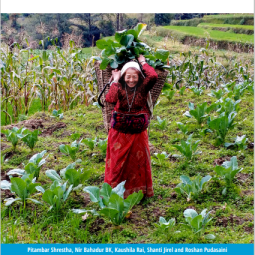
211. Landslide Hazard Mapping: GIS Based Susceptibility Assessment of Leoutikhola Watershed, Dhankuta, Nepal
-
212. Landslide susceptibility mapping along Bhalubang—Shiwapur area of mid-Western Nepal using frequency ratio and conditional probability models
-
213. Landslide Hazard Assessment: Recent Trends and Techniques
-
214. GIS Bases Frequency Ratio Method for Identification of Potential Landslide Susceptible Area in the Siwalik Zone of Chatara, Barahakshetra Section, Nepal
-
215. Landslide Hazard Mapping and its Evaluation Using GIs: An Investigation of Sampling Schemes for a Grid-Cell Based Quantitative Method
-
216. Assessment of Landslide Susceptibility Along the Araniko Highway in Poiqu/Bhote Koshi/Sun Koshi Watershed, Nepal Himalaya
-
217. An Overview of Landslide Hazard Mapping and Rating Systems in Nepal
-
218. GIS Based Landslide Susceptibility Mapping using a Fuzzy Logic Approach: A Case Study from Ghurmi-Dhad Khola Area, Eastern Nepal
-
219. GIS-Based Quantitative Landslide Hazard Prediction Modelling in Natural Hillslope, Agra Khola Watershed, Central Nepal
-
220. Use of Different Bivariate Statistical Landslide Susceptibility Methods: A Case Study of Kulekhani Watershed, Nepal
-
221. GIS-Based Weights of Evidence Modeling of Rainfall-induced Landslides in Small Catchments for Landslide Susceptibility Mapping
-
222. Current and Future Status of GIS Bases Landslide Susceptibility Mapping: A Literature Review
-
223. Natural Hazards Susceptibility Mapping in Kuala Lumpur, Malaysia: An Assessment Using Remote Sensing and Geographic Information System (GIS)
-
224. GIS and Geomatics for Disaster Management and Emergency Relief: A Proactive Response to Natural Hazards
-
225. The use of remotely piloted aircraft systems (RPASs) for natural hazards monitoring and management
-
226. A Survey of Geomatics Solutions for the Rapid Mapping of Natural Hazards
-
227. Flood Hazard Mapping by Integrated GIS - SCS Model
-
228. Geomatics Mapping of Natural Hazards: Overview and Experiences
-
229. Flood Hazard Mapping using Aster Image data with GIS
-
230. NDRRMA’s Comprehensive and Inclusive Approach for New Challenges Posed by Disasters (विपद्का नवीन चुनौतिमा प्राधिकरणको सोच र सर्वपक्षीय सहकार्य)
-
231. Role of CSOs in Earthquake Safety Campaign (भूकम्पीय सुरक्षा अभियानमा नागरीक संस्थाहरुको भूमिका)
-
232. Scenario of Earthquakes in Nepal and the Role of Civil Society Organizations in Earthquake Safety Promotion
-
233. The use of Indigenous Knowledge and Technology for Earthquake Safety Promotion by CSO
-
234. Wildfire Dynamics in Nepal from 2000-2016
-
235. Global Trends in Wildfire and its Impacts: Perceptions Versus Realities in a Changing World
-
236. Forest Fire Situation in Nepal