Webinar on "Real-time Flood and Landslide Monitoring and Innovations (Application of Remote Sensing and UAVs)"
Webinar on "Real-time Flood and Landslide Monitoring and Innovations (Application of Remote Sensing and UAVs)"
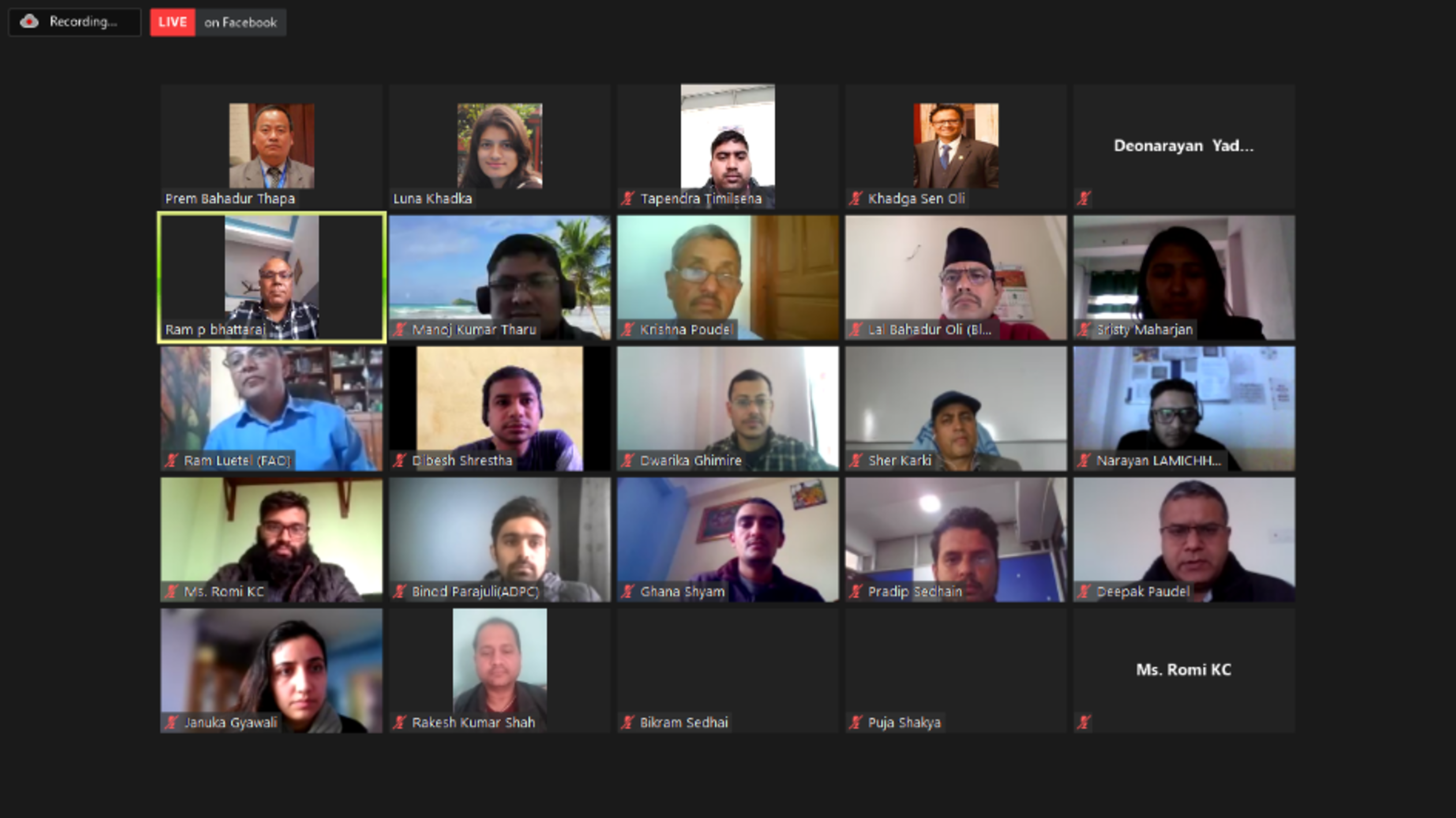
DPNet-Nepal and Practical Action Consulting jointly organized a webinar on February 25, 2021, titled "Real-time Flood, Landslide Monitoring and Innovations (Application of Remote Sensing and UAVs)". The program commenced with Mr. Ram Prasad Bhattarai, Vice Chairperson of DPNet-Nepal, as the chairperson, and Dr. Raju Thapa, General Secretary of DPNet-Nepal, sharing the objectives of the webinar. A total of 85 participants attended the webinar.
Dr. Prem Bahadur Thapa, Director of the TU-QAA Centre at Tribhuvan University, delivered a presentation titled "Landslide Early Warning and Application of Remote Sensing/GIS Techniques." During his presentation, he discussed the use of early warning systems (EWS) for landslides in the Nepal Himalaya region and highlighted the utilization of remote sensing and GIS for data acquisition and hazard analysis in risk reduction processes. Dr. Thapa presented spatial occurrences of landslides, control measures for risk awareness, and mapping techniques, including both earthquake and landslide-induced landslides. He also shared examples of significant landslides. Additionally, he discussed the development of early warning systems in Nepal, emphasizing the ongoing exploration of cost-effective technologies. Dr. Thapa showcased the application of remote sensing and GIS in landslide investigations, including mapping, database development, analysis, and risk reduction strategies. The presentation included high-resolution images demonstrating landslides. Dr. Thapa concluded by summarizing the use and application of early warning systems, remote sensing, and GIS.
Ms. Sristy Maharjan, a Hydrologist Engineer from the Department of Hydrology and Meteorology (DHM), presented on "The Role of DHM in Real-time Flood Monitoring." Her presentation focused on the principal activities of DHM in flood monitoring, which involve establishing and operationalizing flood forecasting stations with real-time telemetry systems, providing weather forecast information, developing river flow forecasting models for major rivers in Nepal, and establishing flood early warning systems in flood-prone areas. Ms. Maharjan emphasized the importance of information sources in flood monitoring, including data from hydrological and meteorological stations, which is analyzed and shared with the general public. She discussed the evolution of flood monitoring and early warning systems in Nepal, highlighting the availability of automatic flood stations that provide real-time information at 5-minute intervals. Ms. Maharjan also mentioned the presence of automatic rainfall and water level stations across Nepal. She emphasized the need for DHM to address urban flooding, study flash floods and develop related models, and strengthen bilateral cooperation with China and India to mitigate the impact of floods and inundations.
Mr. Alberto Muñoz-Torrero Manchado, a PhD student from the University of Geneva representing the Practical Action Consulting team, presented on "Landslide Trends in Western Nepal: An Analysis of Climatic and Anthropogenic Drivers over Three Decades." He discussed previous studies on landslides, which examined the impact of climate change and anthropogenic factors on landslide casualties and frequency. Mr. Manchado shared that a landslide inventory consisting of 26,350 landslides, classified as shallow and deep-seated, and was analyzed. To correlate the dating of landslides annually, an Arc GIS toolbox was developed using Landsat imagery, which could detect sudden changes. More than 8,778 single-event landslides from 1992 to 2018 were dated using this tool, and correlation with climatic variables was established using ERA 5 analysis data. Strong correlations were found between shallow landslides and total monsoon precipitation (r=0.74), 10-day cumulative precipitation (r=0.68), and warm monsoons followed by particularly rainy monsoons (r=0.77). The correlation with climatic variables was strongest in the northwest part of the study area, potentially due to the influence of anthropogenic drivers. Population growth, increased agriculture crops, and road density were analyzed as potential factors. In conclusion, Mr. Alberto Muñoz-Torrero Manchado stated that the climatic conditions of the previous monsoon play a crucial role, especially when warm monsoons are followed by particularly wet ones, resulting in the highest correlations with shallow landslides. The analysis also revealed significant spatial variability in the strength of these correlations, with remarkable demographic development appearing to be a key contributing factor.
The discussion focused itself on the following arguments:
Where should local government bodies contact if they wish to install a Landslide Early Warning System (LEWS)? The installation of EWS is carried out by the Nepal Academy of Science and Technology (NAST). Therefore, the local government can contact the Technology Sales office in Lazimpat, Kathmandu, and purchase the necessary devices.
When and where was this technology tested in Nepal? What are the limitations for its application in Nepal? The technology was tested in Gorkha district. However, due to the high occurrence of landslides, it is currently being used primarily in major landslide-prone areas.
It is necessary to integrate such technologies and tools into the formulation of municipality or rural municipality Disaster Risk Reduction (DRR) plans. Unfortunately, this integration has not been adopted yet. It is crucial to consider these technologies in hazard risk analysis.
Are there any platforms where data and information related to landslide risk and vulnerability assessments are archived for easy access? Although the documents are not confined to a single platform, organizations like ICIMOD and NAST are making efforts to compile such documents.
There seems to be confusion about who should actually own the Landslide EWS. Should it be the Department of Hydrology and Meteorology (DHM), the Department of Mines and Geology (DMG), or other agencies? The ownership should be consolidated under one platform. Organizations like DHM, DMG, the National Disaster Risk Reduction and Management Authority (NDRRMA), and ICIMOD should come together on such a platform.
If an earthquake occurs, will the LEWS system send SMS alerts? Yes, when there are vibrations and ground stretching indicating a potential landslide, the system will send SMS alerts.
How much area can one device cover in a landslide-prone area? Each device can cover one single landslide and its adjacent areas.
What approaches has DHM adopted for monitoring services when the sensor system does not work during extreme weather conditions, power dysfunction, or maintenance of real-time instruments? DHM has manual stations located near real-time stations. In case the system is down, they rely on manual data provided by gauge readers. They also analyze the situation by comparing data from upstream (u/s) stations or nearby stations.
Perhaps we should consider the historic river course when delineating flood polygons. Rivers tend to change their course over time. For example, the right branch of the Karnali River is currently flowing along a path that dates back to the 1990s.
A strong correlation between cumulative rainfall and shallow landslides is generally found in the Nepal Himalayas, while cumulative rainfall is correlated with deep-seated landslides, which is an interesting finding in the research.
Mr. Ram Prasad Bhattarai, Vice Chairperson of DPNet-Nepal, expressed gratitude towards the resource persons, Practical Action Consulting (PAC), and all the participants for their valuable time. He also extended thanks to Atuallya Foundation for providing the Zoom service, enabling the program to be organized virtually.
